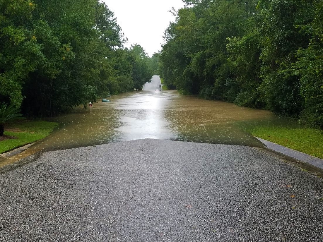
Flooding threatens the social and economic sustainability of communities throughout the Gulf Coast of the United States.
Flooding along the Gulf Coast caused by rain events can cause widespread damage across a region and costs billions of dollars to recover from and restructure social systems. Concerns over water quality can further exacerbate impacts to communities, as pollutant levels in floodwaters have potential to adversely affect human health.
The potential for communities to mitigate flooding and pollution through green infrastructure (GI), landscape features designed to mimic natural processes including vegetative swales, bioretention cells, permeable pavement, rainwater harvesting, and rain gardens, represents an untapped tool to promote the resilience of many communities in Northwest Florida's Santa Rosa and Escambia Counties. Community resilience—the capacity of communities to withstand disturbance and continue to thrive within their environment—can be increased through learning from modeling tools and conducting outreach to illustrate how GI can reduce flooding on the landscape and improve water quality of floodwaters; and over time, through implementation of beneficial projects. The purpose of this project is to increase the resilience of select flood-prone communities in Escambia County and Santa Rosa County, in northwest Florida, to flooding associated primarily with rainfall events.
This project is a partnership among UF researchers, and Santa Rosa County and Escambia County staff, County Extension and Sea Grant, and UF Extension. Our project has three main objectives:
- We collect streamflow and storm event water quality data from areas that frequently flood to describe how rain affects surface water conditions in these areas;
- We use these data to calibrate and validate stormwater models (computer simulations) to predict how green infrastructure could reduce flooding and improve water quality; and
- We hold public workshops in Escambia County and Santa Rosa County, FL to share event rainfall maps and streamflow data, and discuss the benefits of GI techniques; and after the SWMM model is complete, share model results and obtain feedback and recommendations for other scenarios.
At the conclusion of the project, our goal is for our data and model output to be used for informing grants to obtain funds to implement GI projects in Santa Rosa County and Escambia County.
Since October 2019, the project team has held workshops on rainfall dynamics and green infrastructure in Florida.
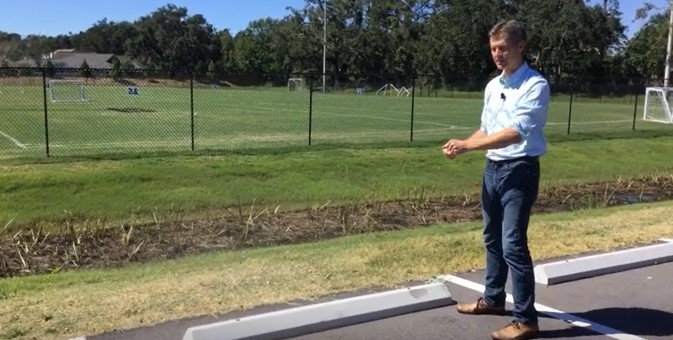
Each workshop included a presentation by University of Florida faculty Eban Bean and Matt Deitch, as well as local engineers and planners who have worked to implement green infrastructure projects in the region. To view Dr. Deitch's recent video on green stormwater infrastructure in Northwest Florida, click the picture or the YouTube link below.
https://www.youtube.com/watch?v=DMP4x41EgiI